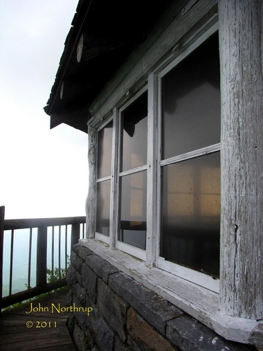
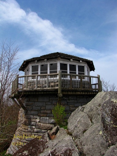
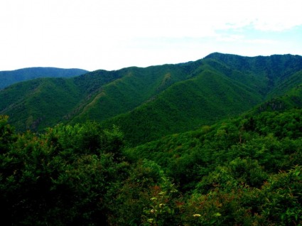
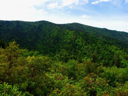
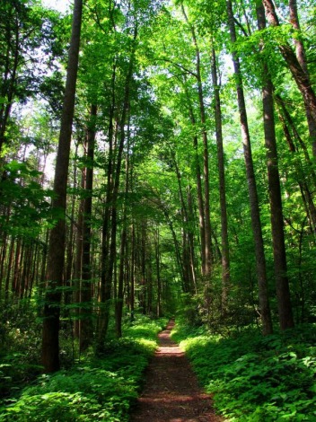
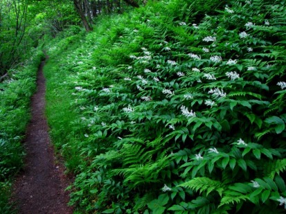
We were in the mood for a return trip to Mount Cammerer to see how it looked with so much more spring greenery than in April. 
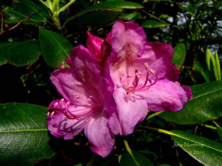
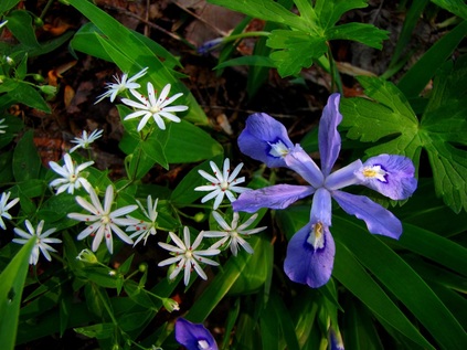
The Catawba Rhododendron were beginning to bloom along the crest of Mount Cammerer. 
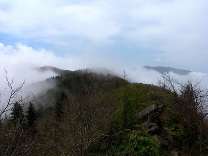
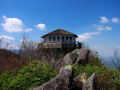
Shortly after our arrival, the clouds enveloped the tower, but not before we could snag some great views of the park's east side.
0 Comments
With hopes of a sunnier afternoon, we took the weather forecast for its word and headed up to Mount Cammerer to behold its spring beauty. Breaks in the clouds above offered rare glimpses of blue skies while everything else remained socked in. Shortly after we left, the clouds broke and we could see peaks and valleys all around, so we immediatley returned to the tower to soak it all up. With the sun's reintroduction, the Trout Lilies began to open their droopy heads. Even the Spring Beauties burst open with the sun's help to cover the mountain in white for miles and miles. Low Gap was adorned with a blanket of White Fringed Phacelia. At trail's end we were treated to one of a few large Vasey's Trillium.
I've got to be honest, Low Gap Trail isn't on the list of favorites. And since going anywhere out of Cosby involves a lot of up, it's still the one to take since it's the shortest. This meant I would be taking this route for the third time in a month and a half. Like my last ascent, I wanted to just get it behind me as soon as I could, so I tucked the camera away and focused on my cadence. Along the way, there was still some mountain laurel in bloom, but many more woodland bluets. When I rounded the corner about a mile below Low Gap, I had visions of running into the two yearling bears again. Thankfully, no repeat encounter occurred and I passed without incident. Before I knew it, I had scaled Low Gap. The forest was even greener and fuller than last time, but there was a welcomed surprise. The workers from Trails Days the past weekend had done a great job of clearing the AT of debries and overgrown brush. You could hear my shines give a big sigh of relief with the absence of crud like nettles. Heading west on the AT, I was going in reverse of last week's hike. Even at this elevation, far fewer plants were in bloom. The amazing displays of false solomon's seal were gone, but a good number of catawba rhododendron were still blooming, especially the higher I got. After moving through Camel Gap, I was once again on new terrain. This 2.3 mile section from Camel Gap to Inadu Knob was all I needed to have completed all the AT between Gregory Bald and Lower Mount Cammerer Trails. Usually when you're hiking the AT through the Smokies, you're following the contours of the main crest; thus, higher than the rest of your surroundings. This portion, though, is interesting in that several vistas along the way afford a hiker the chance to look up at a more dominant mountain ridge extending from the main crest. From a vantage point of about 180 degrees, one can see the entire range from the park's second highest summit, Mt. Guyot, out across the long ridge of Balsam Mountain, then Big Cataloochee Mountain, finally ending at Mt. Sterling with the old firetower visible. The clear skies and heath covered slopes ablaze in reds, whites, pinks from all the mountain laurel and rhododendron added to an already impressive sight. Continuing westward, the AT ascends toward Inadu Knob, sometimes along a narrow ridgeline and even rockier trail conditions. At one point I spooked a deer off the trail and out of sight, but the sound of its snorting could be heard through the trees. It's a sound I've heard before when a deer is digusted with something. They exhale air rapidly through their nostrils and the subsequent sound is like screeching car brakes. I took it that my presence there was unwelcome, so I scooted along. I eventually reached Inadu Knob and knocked out another section of the AT. The last time I was here was five years prior on a backpacking trip with my father. We had come from Newfound Gap and descended from this junction down Snake Den Ridge toward Cosby in two days time. To complete today's loop hike, I too would descend Snake Den Ridge yet again. This time I would take a side a trip out to Maddron Bald, now a heath covered ridge, to soak in some views and see what was still blooming. I found that the bald holds a striking similarity to Rainbow Falls' Rocky Spur. Both are well forested at their edges, far enough away as not obscure the views. Sand myrtle, galax, low growing rhododendron, and mountain laurel dominate the immediate vicinity of the overlooks. And with both, one will see the arm of a ridge extending left and upward toward a much higher mountain crest whose slopes form a wall directly in front of you. At the Rocky Spur, one sees the crest of Mt. LeConte on down to Balsam Point of the Bull Head Trail. Here at Maddron Bald, your eyes follow the roller coaster of a ridge left from Inadu Knob, over Old Black, and right across the long Pinnacle Lead. Choosing to press on, I returned to the Snake Den Ridge Trail and dreaded the descent. As I remembered it was steep and rocky the entire way down to Cosby. Well, in those five years since, nothing had changed. About halfway down, though, I ran into several teams of trail maintenance crews for the park clearing out culverts in the trail to help divert water flows. They had covered a lot of territory earlier that day, so the majority of my trek down had me taking long strides and leaps over the numerous ditches. There was only one viewpoint the entire way, a place where the trees had been purposely cut to allow a glimpse of Mt. Cammerer to the west. Looking closely, the windows and triangular top of the firetower were discernible. Before long, I had strolled into the Cosby campground, recently renovated and reopened entirely to public access. After today's hike, I'm another step closer to completing this corner of the park, and now just ten miles away from finishing the Smokies' portion of the AT. I knew coming into this week that my hikes would entail a lot of elevation gain and loss. Many of my hikes do, but most have been over four or five days across many miles if you include the commute up and down Alum Cave. This week only involved two trails outside of Alum Cave, and less total distance. Today, I would be tackling the Low Gap Trail, one of the park's steeper sustained ascents, so I had my work cut out for me. The terrain was different compared to when I was here a month prior. There were no wildflowers growing down low, just green brush and saplings. Since I was so concerned about maintaining a good cadence on such a climb, I never stopped for pictures. The more time I spend in the mountains, the more in tune I become with the air and my ability to travel very long distances without needing to catch my breath, drink water, or have a snack. I was curious to see how I would hold up climbing Low Gap out of Cosby. Without ever really breaking a sweat, I managed to cross the gap in fifty minutes without stopping, a testament to my physical conditioning. Low Gap looked so strange this time around. There was little sunlight. The spring beauties, white fringed phacelia, trout lilies, and violets were all gone and replaced with tall overgrown brush. The forest was thick and dark. Certainly not nearly as impressive a sight as it was a month ago. The worst of the up was behind me, and it was time to drop down the other side. The southern leg of the Low Gap Trail takes one down a steep and rocky path for about two miles before leveling out near Walnut Bottom. Obviously the less popular half of the trail, it isn't as wide and already overgrown with grasses and brambles in many places. When I reached Walnut Bottom, you could hear the roar of the nearby Big Creek. Between the campsites, the trail is that of an old roadbed and easy on the feet. The trees that grew trailside were noticably tall and proud. I would follow the creek for the next few miles as I made my gradual ascent up toward Camel Gap. Everything about the creek is big. It is wide, the boulders are large, and the various falls, cascades, and slides are bigger than average. The trail reminded me a lot of the upper part of the Little River Trail...narrow, overgrown, paralleling the creek, flies buzzing around your face, and relatively flat terrain. Along the way I almost stepped on a foot and half long snake. I've noticed that I almost step on snakes a lot. Of all the places, they have to sun themselves right in the middle of the trail. I knew it wasn't any threat to me, so I took his picture then watched him slither back into the brush. Much of the climb up to Camel Gap was monotonous until the it leaves creek and swings to the northeast. At one point, the trees make room for mountain laurel, catawba rhododendron and an open view to the green and blue wall that is Balsam Mountain. Luftee Knob stands front and center along a ridge that extends over to TriCorner Knob and the towering Mount Guyot, both just in sight. It was nice to finally reach the AT at Camel Gap because it meant I was on a maintained trail, break from all the grasses, nettles, and other junk most of the way up. From here to Cosby Knob, the trail follows much of the ridgecrest covered in ferns. I was impressed by the long and dense patches of false solomon's seal still blooming. They were more abundant here and with bigger blooms compared to what I had come across elsewhere in the park. After a quick lunch at the Cosby Knob Shelter, it would be all downhill the rest of the way. I completed the loop when I reached Low Gap and began my descent down to Cosby. Things got real interesting about a mile down, when I rounded a corner and came face to face with two yearling bears. At the onset of me, one of sprinted uphill and out of sight. The other one didn't move, his eyes fixated on me. Reaching for my camera was the furthest thing from my mind. I began the process of going through all the steps one should take to stave off a bear. I began yelling, clapping, waving my arms, standing tall to give an impression of dominance. The fuzzy bear did nothing but remain on the trail. Thankfully, on Low Gap Trail, there are a lot of rocks lying around, so I grabbed several and started throwing them close to but not at the bear. I wanted to spook him away, not aggravate him. He didn't budge, so I threw closer. Still nothing. So I said what the heck, maybe he needs a few shots to get the hint. One rock hit him in the side, then a second, and a third right on his forehead. The silly thing didn't even flinch. I began to laugh, and I'm sure he already was. The next item I could use in my arsenal was my backpack, so I took it off and began waving it around in the air combined with more yelling. FINALLY, he trotted up the hill a few feet. He was still close by and watched my every move. I kept my eyes on him as I crab stepped down the trail, holding my pack in one arm like a shield, and in my other hand, a sharp and shiny item that I hope I wouldn't have to use in case he charged. I made it by without a fuss and left him in the dust. I held onto a few rocks the rest of the way down in case I ran into some of his friends. An interesting finish to another great hike in the park.
Thus comes the end of May. It has been a month that exceeded my every expectation. And now comes June, when the mountain laurel, flame azalea, and rhododendron kick into high gear. I'm looking forward to some great hikes, expanding my horizons deeper into North Carolina, all leading up to the culmination at Gregory Bald. Until next time, Happy Memorial Day to all! The forecast was calling for clouds and rain showers in the afternoon, and I had already delayed the hike to Cammerer a day, so it was important I got another early start to reach the firetower in time for decent views. The fact that I was taking the long way up and around the mountain meant there was little room for lolly gagging. The task was difficult with the abundance of wildflowers the entire way up Lower Mount Cammerer, but the improvement in the day's weather allowed me to enjoy my surroundings and ease up on my cadence. Within the first mile out of Cosby Campground, phlox, wild geraniums, violets, and showy orchis were the norm. I was afforded some nice views from the Sutton Ridge Overlook along the way, situated where the spring greenery had arrived down below and just beginning up above. The best areas for wildflowers tended to be on the more shaded, eastern facing slopes while the crested dwarf iris dominated the western faces. The first half of the trail up saw the irises in full bloom and budding throughout the second half, likely to erupt next week. Higher up, I was impressed with the trail conditions. It was evident that work had been done recently to improve the path and footing. Blowdowns were cut and cleared and much of the earth around them removed. There were also several long stretches where the earth had been dug out and the path widened. The soft dirt was so pleasant on the feet, especially after going more than seven miles at that point. Shortly after arriving on the AT, the trail dynamics changed dramatically. The grade had steepened, and the rocks and log steps, probably to prevent erosion, were more annoying than exhausting. I would have preferred a gradual slope over having to push up on steps for more than two miles. Regardless, the skies were clearing and new wildflowers were appearing. The rocky slopes of Cammerer were adorned with spring beauties and trout lilies. There were even a handful of witch hobble trees in bloom. It was evident that this is the time of year when AT thru-hikers are making their way north from Georgia. Just inside of the 2.3 mile stretch between the trails of Cammerer, I passed some three dozen backpackers compared to one day hiker. And I was the only one going up. Some looked energetic while others already seemed famished. Some were in pairs while others were alone and plugged into their ipods. Finally reaching the junction with the trail to Mount Cammerer, one could see that the spring beauties and trout lilies were putting on quite a show. The slopes were covered in white and speckles of yellow as far up and down as I could see. The ups and downs after leaving the AT are enough to drive somebody nuts in anticipation of arriving at the tower. Eventually, the brush cleared and the outcrop of White Rock was in sight. It had been close to a decade since I was last here, and what was better once more was that I had the entire summit to myself for close to an hour. I circled the tower several times before finally deciding to relax and eat some lunch inside. The serviceberry trees that graced the ridges were in peak bloom and the valley floors below were filling in the with green. Mount Cammerer makes for a great destination to check out the progress of the spring season. The majority of the trail from the tower to Low Gap was lined with the snowy appearance of spring beauties, dotted with intermittent trout lilies. It made for some pleasant walking along the ridgeline. The biggest surprise of the descent came when I rounded a corner that would remove Cammerer from sight. Along a dry, western facing slope, there were a handful of wildflower patches consisting of thyme leaved bluets. I was astonished for I wasn't expecting to these dainty little flowers until another month or two. Plus the fact that they were already blooming this high up added to the wow factor. When I arrived at Low Gap, the white fringed phacelia were just beginning to open up. I remember seeing pictures from a previous hike my father took along this trail, perhaps the same day of the year, when the phacelia and trout lilies were in peak bloom together. Another sign of the odd start to spring, the trout lilies appeared to be past peak here while the phacelia were just getting started. The descent down Low Gap went by quickly, in part to the steep grade. My return to Cosby was greeted by more of the blue phlox, wild geraniums, and foam flower that saw my morning departure. Here it was late in the afternoon and the weather remained sunny and clear. Another great day in the park.
|
Thanks for visiting!I appreciate you stopping by. This site is for your enjoyment as much as it is mine. Look for new photos and journal entries about every 1-2 weeks. Archives
November 2011
Categories
All
|